On to my big adventure! I caught the water taxi early from Picton on Friday to head to my chosen starting point on the Queen Charlotte Track, one of New Zealand’s “Great Walks.” The whole thing is 70 km (43 miles), but I started about 20 km into it. It would have been doable in three days if I’d booked my accommodation differently, but I was happy with doing just over 30 miles as an intro to multi-day hiking in NZ. To give you an idea of the track, here’s a map:

I started right at Punga Cove Resort and headed towards Debrett’s, my lodging for the first night. This would be my longest day of hiking, at just over 15 miles. I figured I would need some fuel, so I stopped at Punga Cove’s cafe for a flat white. Not a bad view!

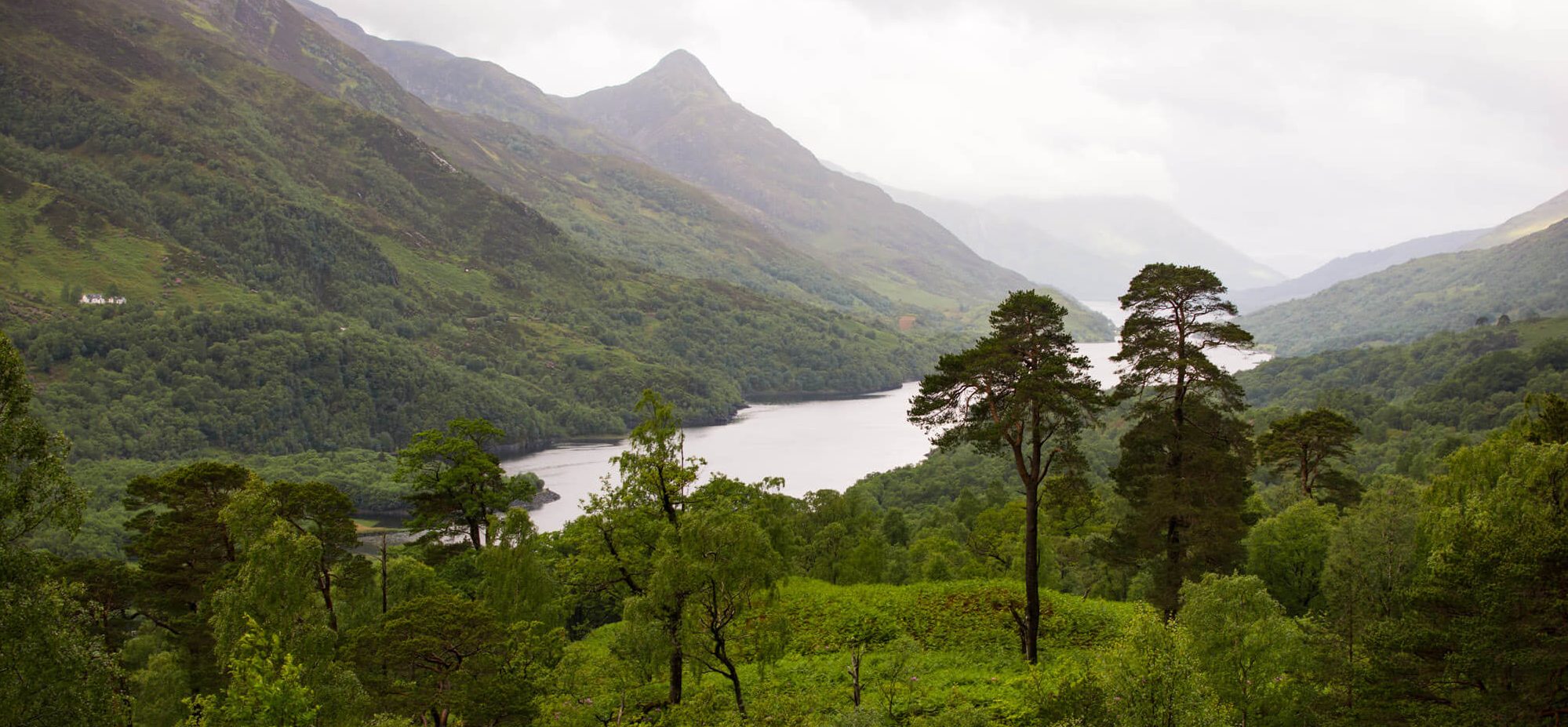
Once I set off on the track, I was immediately blown away by the scenery, and I hadn’t even climbed beyond sea level yet.

The track began to climb pretty steeply as soon as I turned inland. I did my best to pace myself, knowing the distance I had to cover.

A small portion of the trail ran along a road, but there were no cars in sight.

This was the point where I started to shed a lot of the layers I thought I’d need. In NZ, you’re always overdressed or underdressed, since the weather and temperature shifts so quickly.
After leaving the road, the trail wound through low forest and along grassy ridges. It didn’t take long for the view to start peeking out around bends in the track.

Predictably, I soon began encountering interesting signs. Kiwis really love their signs, which typically show you the distance to various New Zealand cities and often feature impossibly distant international locations, too. They always serve as a reminder of how remote NZ truly is.

Don’t let the signs distract you from the view, though.

I wasn’t sure whether this next sign was suggesting I “look out,” or if a “lookout” was coming up. Fortunately, it was referring to a scenic lookout.

Look out for a lookout!

Said lookout provided an incredible spot to eat my lunch and rest my feet.


Of course, there was another sign.

So, I had to pose with it.

It was hard to move on from a spot with views like this, but I had a good deal of distance still to cover. Luckily, more amazing views awaited me.

I encountered quite a few wekas along the path, but only managed to get a picture of one. They look a lot like funky brown chickens.

Annnnd… more signs!

That one featured some unexpected locations. In summary, they are all really really far.
The weather got a bit rainy, but luckily I had a good pack cover and needed some cooling off anyway. The forested parts of the track also provided convenient shelter, like this arboreal tunnel.

No weather could detract from Queen Charlotte’s views.

This track really showcased the immense variation of the New Zealand landscape. One minute, the forest would almost look like places I’ve been back home in America, and the next minute, I’d be in the rainforest.

That’s one of the things I love most about New Zealand. You truly never know what you’ll encounter around the next bend, and every path is a new adventure.
Soon, I could see Picton in the distance, across Queen Charlotte Sound.

It’s really hard to look down at the path when you have THIS view to your left.

Luckily, I didn’t step off the edge.

The remainder of the path wound gradually downward through dark forest. This was the part of the day where I really just wanted to reach my destination, since I no longer had views to keep me going. The whole trek took just over six hours, which included several stops for eating and soaking in the scenery, but my legs were starting to resent the uneven terrain. I finally hit a road and saw signs for Portage, the small settlement (can’t really call it a town) where I was staying for the night. My lodging, DeBretts (owned by Deb and Brett), was incredible. Not only was I greeted by a dog, but the views were like something you only see on a desktop background or screensaver. WOW.

I sat on the porch with a cup of tea and tried to tell myself I wasn’t dreaming.

I was pretty exhausted, so I went to bed early in preparation for my next day on the track. That will be covered in my upcoming post, so don’t change the channel just yet.

The pictures are so beautiful. I want to do that trek the next time we go to New Zealand. Once again, you’re making me feel warm on a cold and snowy day in Massachusetts.
LikeLike
I’m glad I can be the fire to warm our cold Bolton home.
LikeLike
Spectacular as always, Kelsey. Love the weka!
LikeLike
Thank you! The weka would like you, too.
LikeLike